My girlfriend Sarah and I just finished a 2-week trek in the Annapurna region of Nepal from Oct 16-30, 2019. Here’s the report.
Click here for a map that covers days Day 1-8 and click here for a map that covers Day 9-14.
Day 1: Kathmandu → Besi Sahar → Koto (travel day)
The most challenging part of trekking in Nepal isn’t the high altitude, rough trails, or frigid teahouses–it’s simply getting to the mountains in the first place.
Today we spent 7 hours on a public bus from Kathmandu (the nation’s capital) to the town of Besi Sahar and another 6 hours in a 4×4 jeep to the village of Koto (where our trek actually began).
Nepal’s best highways are America’s worst roads. There are no lane lines, traffic signals, or guard rails. Pavement exists infrequently, and even the national highway is littered with rocks, former landslides, stream crossings, and broken-down vehicles in the middle of being repaired. There’s no flat terrain in the country, so every road is a winding mountain road. Traffic jams are common–typically a product of two large vehicles failing to pass each other on a narrow stretch of road with a 500-foot gorge just inches away–so it’s best to add a few hours to whatever time estimate your guide or trekking company suggests.
The second half of the journey involved a truly crazy (not a word I use lightly) journey up a rock-strewn 4×4 road that I didn’t photograph as to not frighten my mother.
You may have heard that “they’re paving the Annapurna circuit,” so you should hike it now before it disappears. I’ll have more to say about that soon, but yes, it’s true–we opted to drive on the new road (which is definitely not paved) instead of hiking the multiple days to our starting point. We passed a number of hikers who looked fairly miserable as a string of noisy, dusty jeeps (us!) rumbled by. Yes, we were part of the problem. But no, it wasn’t just western tourists taking these jeeps up this pristine valley; it mostly appeared to be Nepali and Indian tourists. We shared our jeep with a boisterous group of twenty-something Nepalis who were sporting designer clothing and the latest iPhones and taking videos, sending snaps, and checking Instagram as often as their western counterparts.
Day 2: Koto (2,600m) → Meta (3,560m)
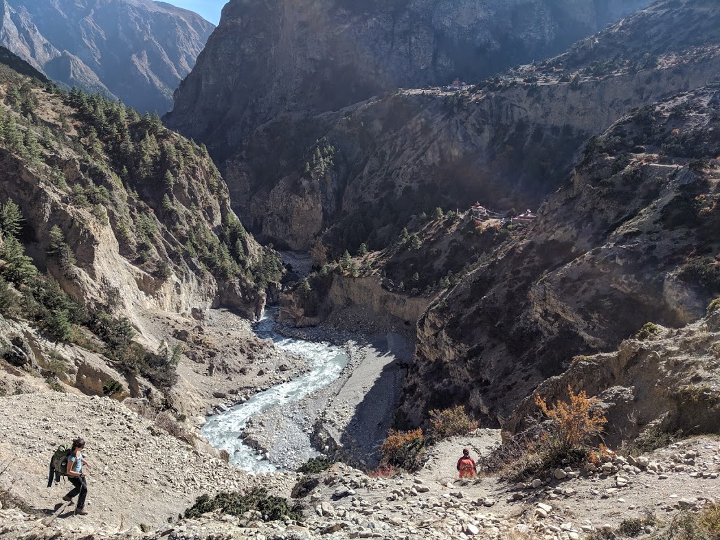
From the roadside village of Koto we began our trek into the “Nar Phu” region of the Annapurna Conversation Area, which Sarah and I discovered when researching alternatives to the Annapurna Circuit (which we knew to be quite crowded). We had to pay an extra US$15 per day for right to entry this “special permit area,” but it was completely worth it in the end.

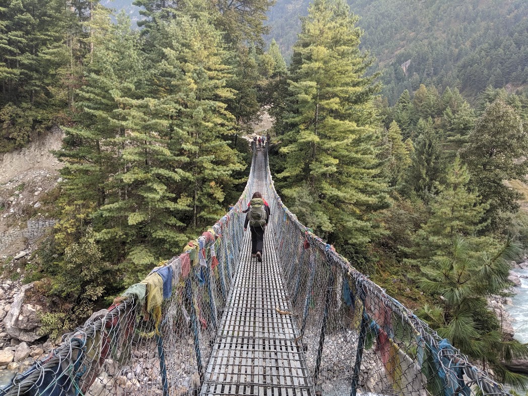

Up and up we travelled through a narrow valley boarding a raging river, cutting through alternating groves of evergreen and deciduous trees flaunting their fall colors. We gained roughly 3000’ in elevation, leaving us at the village of Meta at 11,680’. A big first day!


Day 3: Rest day in Meta (3,560m)
We spent the day in Meta in order to acclimatize. There’s not much to do in these little teahouse villages but amble around, read books, talk to mules, and huddle in sleeping bags in your frigid room. (Temperatures dipped below freezing soon after sunset.) We chatted with a French trio—a mother, daughter, and random guy who had joined their trekking group—whose itinerary we ended up paralleling for the next week.


Day 4: Meta (3,560m) → Phu (4,080m)
Feeling rested and strong, we continued our journey up the gorge, walking on intricately crafted rock paths sometimes cut straight out of the cliffs. My brief experience as a volunteer trail builder with the Tahoe Rim Trail Association helped me grasp how incredibly difficult it must have been to create these trails with only hand and mule power.

Day 5: Rest day in Phu (4,080m)
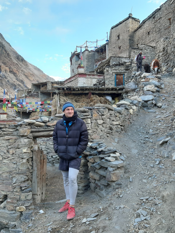
Phu is a lovely, bustling village that, according to our guide GB, was populated by Tibetans for hundreds of years (it’s not far from the current Tibetan border), was “rediscovered” 50 years ago, and now houses a Nepali population of a few hundred. We walked around town in the early morning as locals herded large groups of cows, goats, and yaks from their stone-walled stables into the upper meadows to graze.


Later we ventured up to the hilltop Tibetan temple (where a real Tibetan lama was apparently in residence) and snapped some epic photos of the surrounding Himalayan mountains.


At the monastery we found a little room with colored light coming through a sheet of plastic that covered a hole in the ceiling. Dramatic photos ensued.


Fun fact we learned today: “Himal” means “mountain,” and “laya” means range. So the mysterious and exotic “Himalaya” is really just “the mountain range.”

Day 6: Phu (4,080m) → Nar Phedi (3,490m)
After spending a full day above 13,300’, our lungs felt strong and hiking downhill to the monastery at Nar Phedi felt relatively easy. (“Relative” because even on the downhill days we would encounter brief, vicious uphills that took our breath away.)

The monastery was our favorite accommodation on the entire Nar Phu trek. The room was clean, “warm” (i.e., not a complete icebox), and had an electrical outlet (our first since Koto). The dining room had cushions, heating, and affordable masala tea.

A small group of teenage monks lived on the premise, ate at the same time as the tourists, and shot fun glances and smiles in our direction. We even got to observe the monks as they performed a Tibetan “puja” ceremony with traditional chanting, horns, and drums. (Monks not pictured, because… come on.)
Day 7: Nar Phedi (3,490m) → Nar (4,110m)
This morning we made the short and steep jaunt from Nar Phedi (“phedi” means “bottom of the hill”) to Nar proper, the other major village on the Nar Phu circuit.


Much like Phu, we encountered a lovely, bustling community that centered around animals: yaks, horses, mules, goats, sheep, cows, and chickens. We ate lunch alongside Ian and Amy, a friendly late-twenties British couple that shared our itinerary (alongside the French trio) for a number of days.


Day 8: Nar (4,110m) → Kang La Pass (5,240m) → Ngawal (3,660m)
On the final, big day of the Nar Phu circuit we departed at 6am to make the steady uphill approach to the daunting Kang La pass, a gain of 3,700’ to the 17,200’ height of the pass. We passed a very satisfying number of yaks en route: my favorite member of the Himalayan fauna (followed by the blue goat and pika).


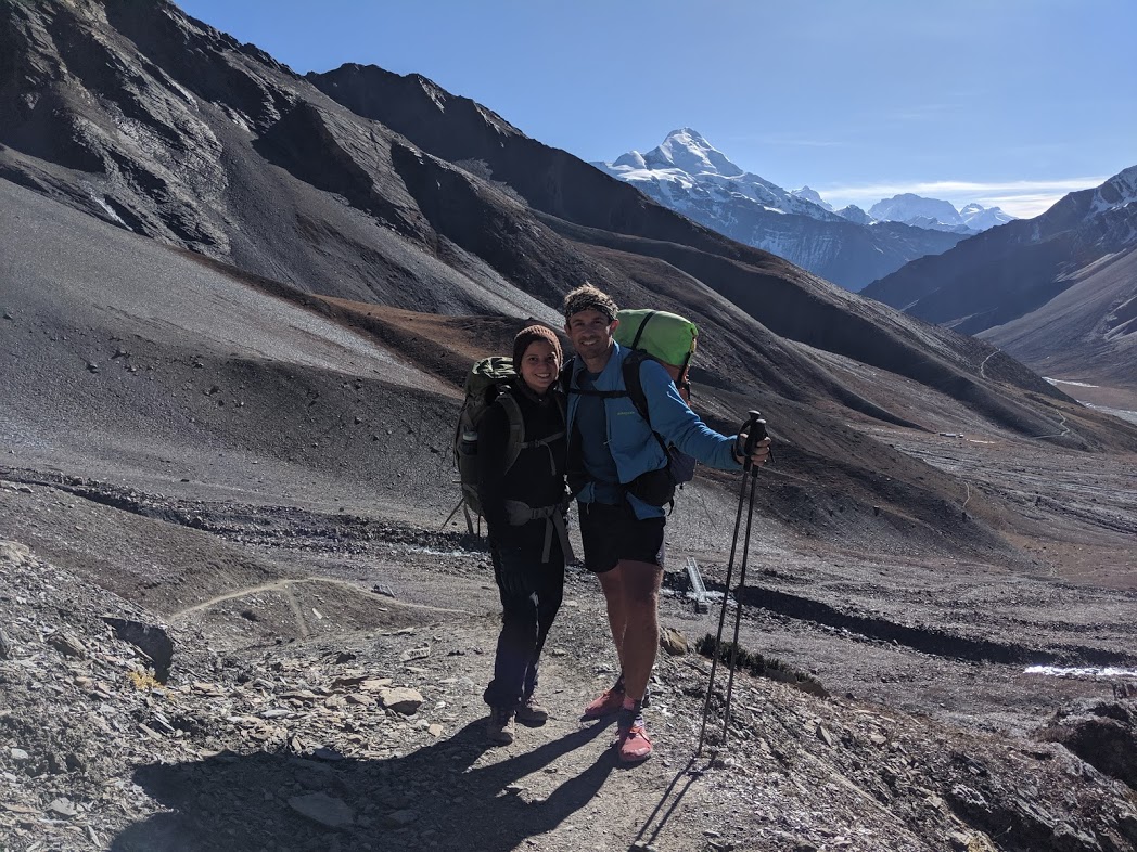
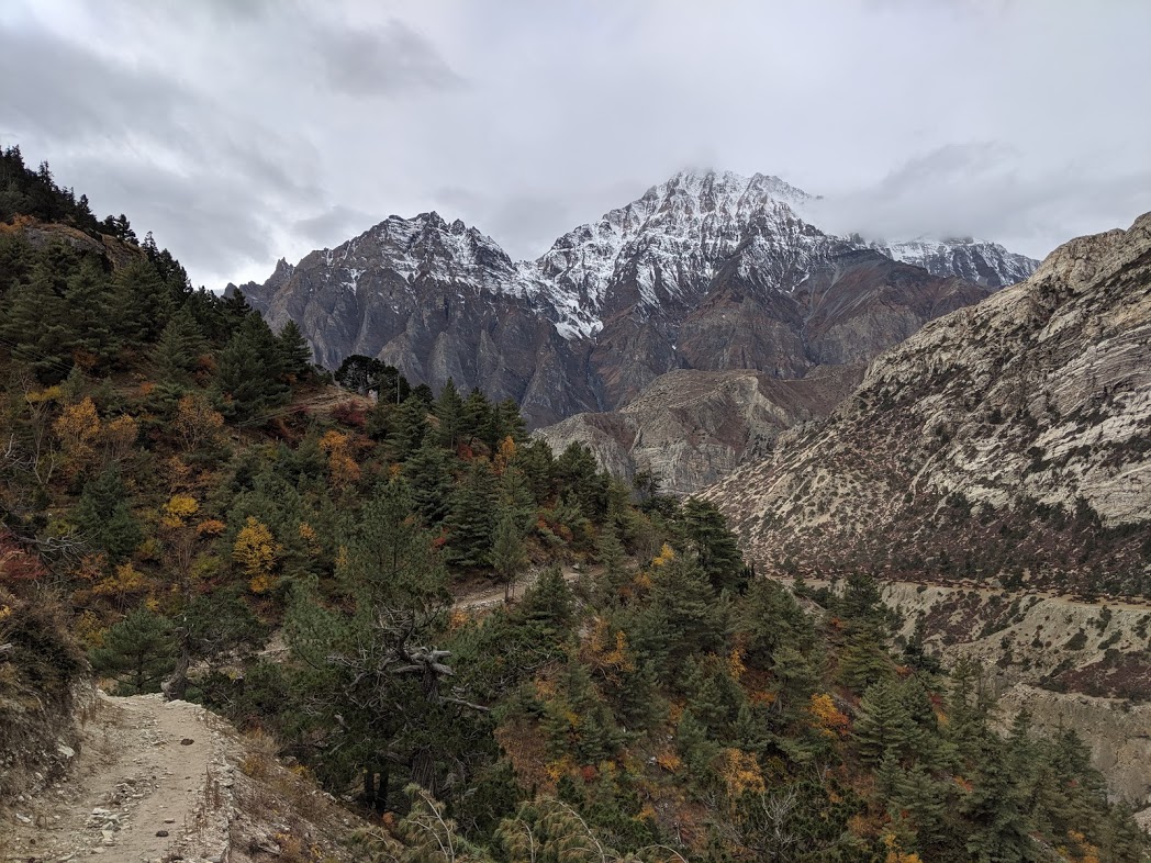
After a slow final push up rocky switchbacks we crested Kang La and enjoyed sweeping views of the Annapurna Range (specifically Annapurna 2, 3, and 4—Annapurna 1 is actually not visible from anywhere we hiked).


Down, down, down he hiked, first through shale fields and then mixed forest, ending our day in bustling Ngawal, a village along the Annapurna Circuit proper where we immediately felt overwhelmed by the crowds. (We didn’t complain about the hot showers and wifi.)


Day 9: Ngawal (3,660m) → Manang (3,540m)
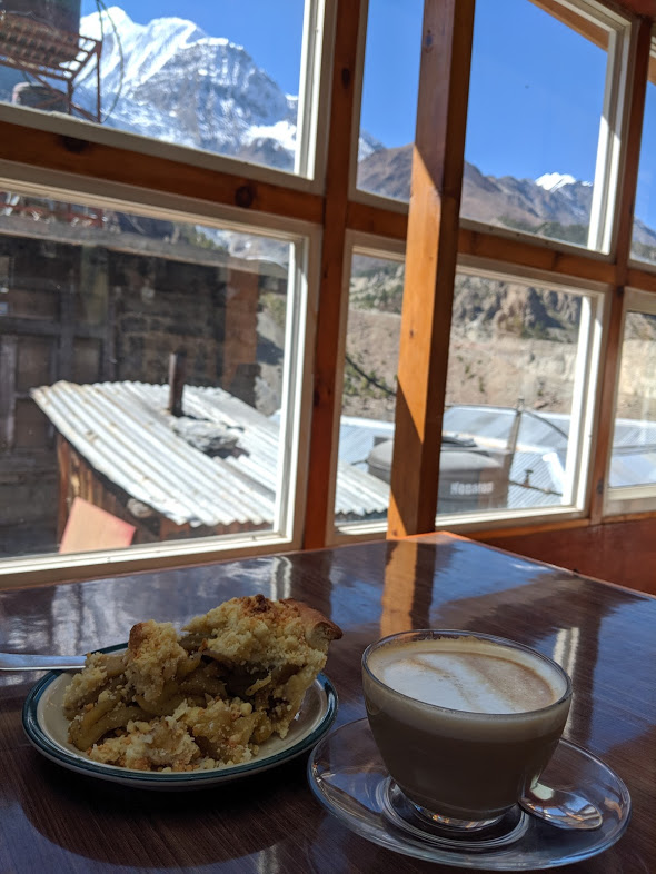
After a brief jaunt to neighboring Manang, the true “start” of the Annapurna Circuit (because that’s where the jeep trail ends), we lazed and luxuriated with espresso, pastries, wifi, and a dinner menu that departed from the noodles, potatoes, and dal bhat (lentils and rice) that comprised the bulk of our meal options for the last week.

Day 10: Manang (3,540m) → Tilicho Base Camp (4,150m)
After shoving one more Real Coffee and Real Pastry into our mouths, we headed in the direction of Tilicho Lake, a popular side journey from the Annapurna Circuit.


We didn’t realize quite how popular it was, though, until we crossed dozens of other tourists (mostly Nepali) as we neared our destination, Tilicho Base Camp, which was fully booked despite our early arrival at 1:30pm. GB did manage to secure us cheap space in a dorm room which consisted of 9 mattresses arranged edge to edge on a floor, which we shared with hikers from France, Russia, Nepal, and China. (We should feel lucky; GB had to sleep one the floor of the dining hall.)
That evening we dined alongside a large group of middle-aged French trekkers, which were a common sight at that point. For some reasons—perhaps French holidays—we encountered an overwhelming number of French hikers along both the Nar Phu trek and Annapurna circuit.
Day 11: Tilicho Base Camp (4,150m) → Tilicho Lake (4,919m) → Siri Kharka (4,200m)
Up, up, up we hiked in early morning darkness toward Tilicho Lake, which our map described as the highest lake in the world (even though there are larger and higher lakes in Tibet). The lake itself was underwhelming—I’ve spent so much time at Lake Tahoe that it was a tough sell, admittedly—but we did witness two avalanches take place. Fun!


We spent the rest of the day hoofing it back toward the main Annapurna Circuit, finally kicking our heels up at the lovely village of Siri Kharka where we dined on yak burgers for lunch and yak salami pizza for dinner, accompanied by a friendly Czech couple, Yan and Nicole, who we encountered many times over the next few days.


Day 12: Siri Kharka (4,200m) → Ledar (4,200m)
Today’s straightforward hike connected us again to the official Annapurna Circuit. Don’t let the elevation change fool you—we went up up up, down down down, and then up up again. Final elevation change is not the same as cumulative elevation change! Unfortunately neither Sarah nor I had a way to track our mileage and elevation gain like Fred did on the Sierra High Route.


Day 13: Ledar (4,200m) → Thorung High Camp (4,880m)
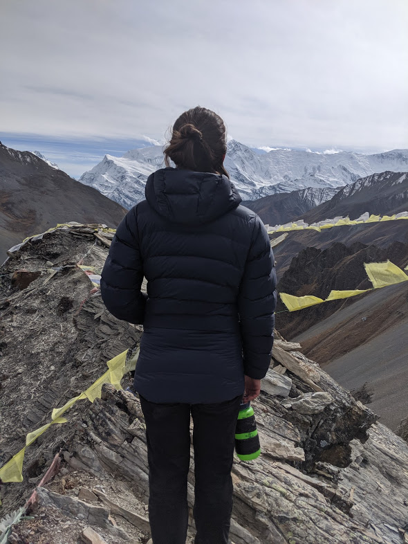
Have you ever spent the night at 16,000’? Neither had I until we made it to Thorung High Camp, the final teahouse before the infamous Thorung La Pass. After a steep scramble up to the Camp, we ate lunch with yet another French cohort and then stumbled up to the viewpoint, where we snapped great photos of the surrounding landscape (here is a sweet panorama). High altitude is supposed to disrupt your ability to rest, but we both slept like babies.


Day 14: Thorung High Camp (4,880m) → Thorung La Pass (5,416m) → Jomsom (2,700m)
Ascending the final 1750’ to Thorung La Pass was surprisingly gentle and easy. Despite our slow pace, Sarah and I arrived ahead of schedule. At 17,769’, this was the highest either of us had ever been (and, I suspect, the highest I will ever go in my life).


The rest of the day was a long, long, long downhill walk to the town of Muktinath, which we found unappealing. In the afternoon we pushed on to our final destination, the city of Jomsom, which added up to an epic 11-hour day with 9000 feet in descent.


Day 15: Jomsom → Pokhara (travel day)
The roughest bus ride of my life. If you have $125 to spare, fly the 20 minutes from Jomsom to Pokhara instead of taking the 12-hour local bus.
In Pokhara we bid adieu to GB, moved into our Airbnb apartment (insanely posh by trekking standards), took hot showers, and ate three plates of momos. Trek, complete.
Fast facts:
- Average cost per day, per person, for trekking service (guide fees, agency fees, permits, transport): US$50
- Average cost per day, per person, for food and lodging: US$25
- Most expensive food & lodging: Phu
- Most difficult section: Kang La Pass
- Best food: Manang
- Most charming animals: Nar
Final advice for those considering this trek:
- The Nar Phu trek is lovely and not yet despoiled by crowds and commercialism—go do it now, while you still can!
- As two reasonably fit hikers who also took our time, we enjoyed the pace of the day-to-day itinerary (perhaps excepting our crazy final day). Approved!
- The Annapurna Circuit was once a 20-day trek; now you really only need three days to do the circuit from Manang to Muktinanth (the two ends of the jeep road). This section, as well as the Tilicho Lake spur, is highly impacted. You often must rush from one village to the next in order to secure lodging for the night (especially if you’re trekking without a guide who can call ahead and reserve space). Our time on the Annapurna circuit was “okay” but we don’t highly recommend it.